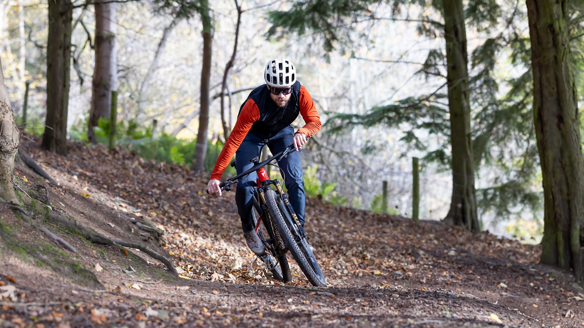
Best apps for mountain biking: useful apps that will compliment your riding
Get the most out of your time on the trails with the best apps for mountain biking
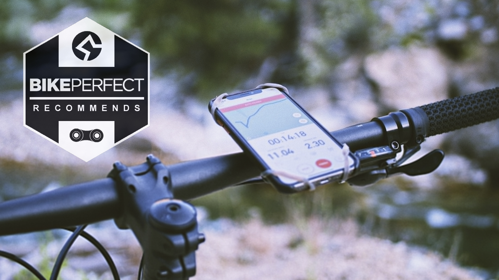
It’s incredible how much value apps can bring to cycling, in terms of opening up possibilities, making life easier and making things more social. They may not be essential — it’s not as if mountain biking wasn’t fun and social back in the day, and who wants to always be spoon fed? — but we’re quite happy to keep the ‘hello birds, hello trees’ side of biking alive, and be able to use apps to plan and follow a 150-mile off-road bikepacking trip without any hassle. That’s why it can be a great idea to make use of the best apps for mountain biking out there.
If that’s what you’ve come here for, then read on for our pick of the best apps for mountain biking that will work with your phone and/or the best MTB GPS computers. We’ve broken this guide into apps for mapping and routes, apps for riding better, and a couple of invaluable apps that you can use in an emergency.
Best apps for mapping and routes
A combination of apps (and their desktop equivalents) is often better than a single one — if you want to find ideas for routes, navigate round them, and brag about them later. For example, you might use Komoot to suggest a broad off-road route, OS Maps to check if it's legal, and Ride With GPS to navigate it. Or, you could combine Trailforks with a bit of reverse engineering on Strava to drill down into singletrack.
Always bear in mind that GPS tools will eat your phone’s battery, so consider taking a spare battery pack and working out a way of waterproofing it if you’re out for a long time in unpredictable weather conditions.
Trailforks
Specifications
Reasons to buy
Reasons to avoid
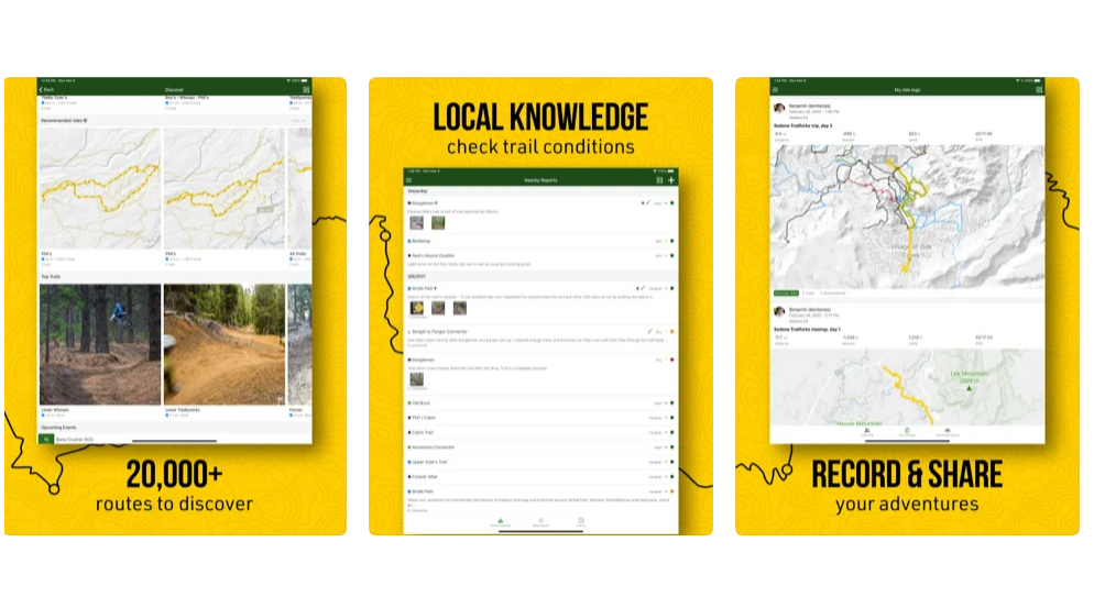
While it doesn't feature every off-road track in the country, you won’t find a more comprehensive or useful guide to discovering new singletrack. Trails are graded and named, riders and trail owners can update details about conditions, and it works offline (on the paid version) and plays nicely with some GPS units too. It’s recently moved to a mostly paid-for model, which has irritated some users, but the website remains free, and you can see that it can’t be a cheap platform to run.
Also consider: Komoot: While its off-road A to B suggestions are best only used as a starting point, its library of curated routes is pretty good, especially its bikepacking routes.
Strava
Specifications
Reasons to buy
Reasons to avoid
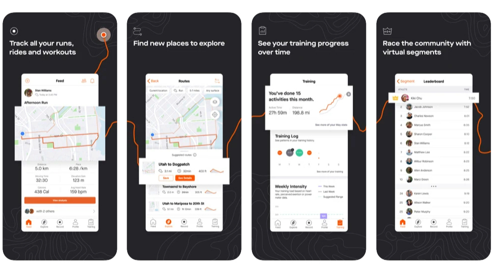
If you don’t like commenting on friends’ rides or seeing photos, and you don’t have a competitive bone in your body, you could possibly live without Strava, but even then it’s a great tool for keeping track of what you’ve done, and increasingly, for planning rides. At its core are key ‘segments’ of road or track, which are auto-timed as you ride them. That means you can easily see how you’ve done compared with previous times, or see how you rank against others. It’s super easy to turn previous rides into repeatable routes, it’s good for seeing where other people have been, and you can reverse engineer sometimes to get ideas for full routes, if their profiles are public, and it all works smoothly.
Also consider: Relive: Mountain bikers love it for the way it plots flythroughs of your route onto 3D topo maps, but it also has neat photo annotation and sharing features.
Ride with GPS
Specifications
Reasons to buy
Reasons to avoid
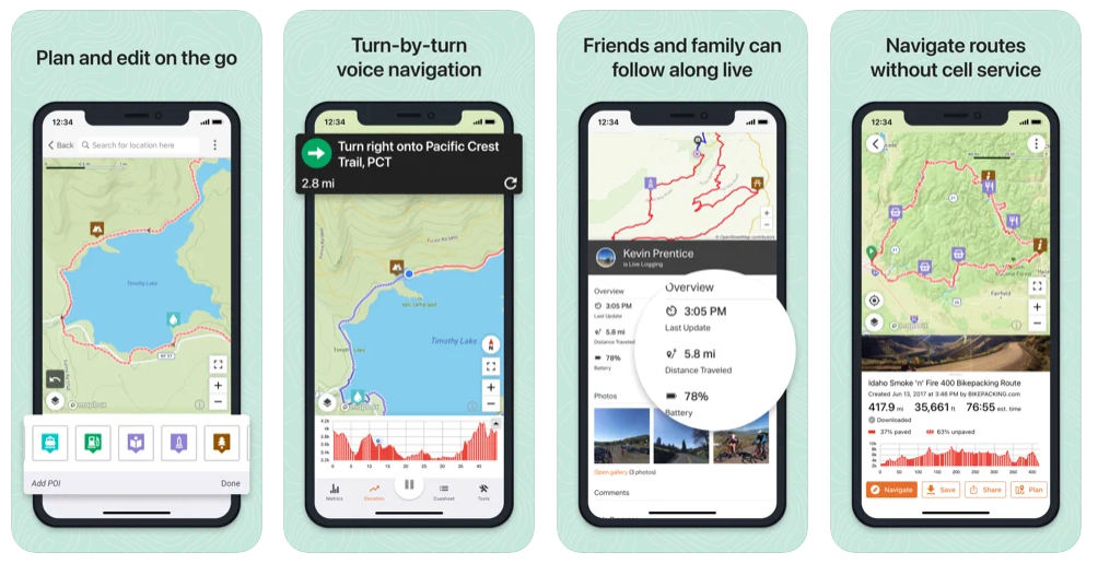
Great for planning and navigating, with really clear turn-by-turn instructions and a number of map options, you can see how the popular favorite Ride with GPS has been refined over many years. Like many apps, it works best if you plan rides on a computer and then use the app for navigating. It’s great for seeing other users’ routes and sharing, too. Some of the more useful navigation features are only in the paid version, so be aware of that.
Also consider:
Komoot: good for navigating, route suggestions (up to a point and particularly on official cycle routes), curated routes.
OS Maps: brilliant mapping, no turn-by-turn navigation, but always good for a clarification of where you are versus less detailed maps
Google Maps: A great backup, especially if you just want to get off the hill and back to your car (or to the pub). Don’t forget you can download sections for offline use.
Best apps for riding better
Ryan Leech Connection
Specifications
Reasons to buy
Reasons to avoid
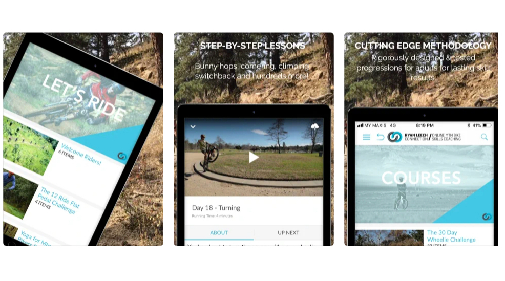
It’s one thing watching skills videos at home; it’s another thing trying to put it into practice on a real-life trail. There are surprisingly few ‘on the bike’ coaching apps (even fewer after the demise of the Scottish Dirt School app, and Trail Tips), but pro rider and coach Ryan Leech puts his experience to use in this companion app to his MTB coaching business. As well as being able to view offline videos, you can upload your own videos for unlimited feedback from coaches and other members.
“I’m not interested in riding the biggest, baddest lines,” Leech says, “what I strive for is beautiful style and technique and that’s embedded into all the teaching.”
At $19 a month / $171 a year, it’s not cheap, but it’s less than a day’s real-life coaching, and you can start with a free trial.
Also consider: YouTube Premium, for taking videos on the go. Still not cheap, at $11.99 a month, though there’s a free three-month trial.
Bicycle Maintenance Guide
Specifications
Reasons to buy
Reasons to avoid
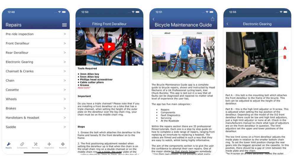
YouTube has a number of good (and more not-so-good) bike maintenance videos, but the last thing you need on a cold wet trail is to try to find the one you need to get you home, or to find you don’t have signal. For the price of a coffee, this fully offline app gives you over 100 sections with photos and videos, including ‘get out of jail’ roadside tricks, fault diagnostics and more detailed repairs and servicing advice. Created by a pro team head mechanic it’s based more around road bikes than MTBs, so it doesn’t cover suspension, but it does include content on electronic gearing and disc brakes as well as more universal maintenance.
Also consider: ShockTune - one for super-nerds, this won't tell you how to adjust your shocks, but it will record the effect your changes are having on the forces that go through the bike as you ride. Fiddly to set up.
MTB Hangtime
Specifications
Reasons to buy
Reasons to avoid
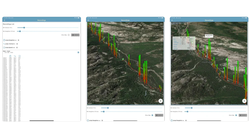
MTB Hangtime uses your phone’s accelerometer to give you a ridiculous amount of data about your airtime and cornering and let you compare your runs. Will it really help you ride better? Maybe not, but it’s super cool to be able to see colored height bars overlaid on a map and the arc your bike (and hopefully you) took through the air — and even the g-force you were pushing around berms.
Apps for safety
Why trust BikePerfect
Best apps for safety
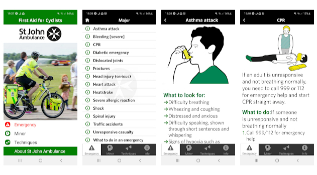
St John Ambulance First Aid For Cyclists
Specifications
Reasons to buy
Reasons to avoid
The main free St John Ambulance First Aid app is available for iOS and Android and covers a huge range of emergency situations, with offline access. Their free First Aid For Cyclists app is Android only and focuses on a bike-related subset, from fractures and traffic accidents, through to asthma attacks and heatstroke. It’s based on UK protocols and includes UK and European emergency service numbers.
(If you have phone signal in the UK, also be aware that 999 staff are able to calmly talk you through potentially life-saving actions, including CPR).
Also consider: First Aid: American Red Cross
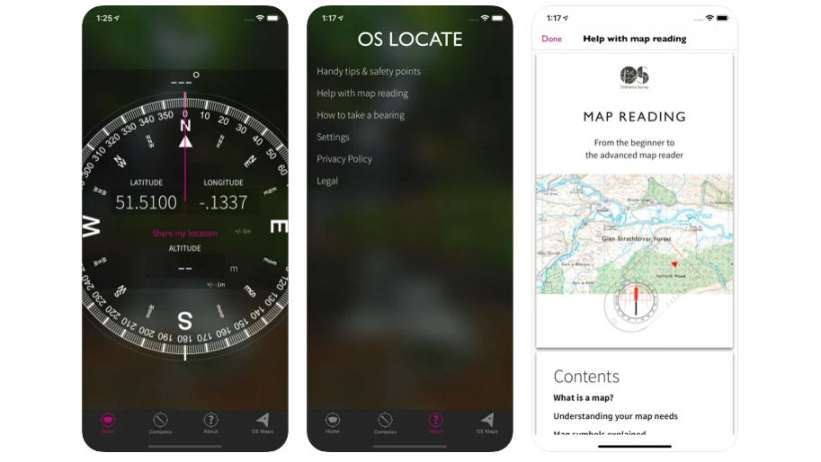
OS Locate
Specifications
Reasons to buy
What3Words is a clever location app, but it can occasionally send emergency services to the wrong place, either through rare algorithm errors, or through user errors, like spelling mistakes. Rescue teams recommend the simple and reliable Ordnance Survey OS Locate app for giving a clear six-figure grid reference, even when you are offline (it also gives your altitude and a super-clear compass bearing, which is great for navigation).
Also consider: letting people at home see where you are by turning on the tracking function on your navigation app, like Strava Locate — though this will only transmit when there’s a data signal.
Sean has old school cycle touring in his blood, with a coast to coast USA ride and a number of month-long European tours in his very relaxed palmares. Also an enthusiastic midpack club cyclocross and XC racer, he loves his role as a junior cycle coach on the Kent/Sussex borders, and likes to squeeze in a one-day unsupported 100-miler on the South Downs Way at least once a year. Triathlon and adventure racing fit into his meandering cycling past, as does clattering around the Peak District on a rigid Stumpjumper back in the day.
Height: 173cm
Weight: 65kg
Rides: Specialized Chisel Comp; Canyon Inflite CF SLX; Canyon Aeroad; Roberts custom road bike
